The Best Free GIS Software
GIS, or Geographical Information System, the software offers advanced mapping features in open-source or commercial programs. There are plenty of free GIS software options available to fit the specific needs of your business. This post will help you determine which free GIS software best fits your use. The four GIS software products covered in this post are:
| GIS Software | Programming Language | Supported OS | Ideal for Basic Map Production? | Biggest Pro | Biggest Con |
| QGIS | Python | Windows, Linux, Mac | No | 3D imagery, plugins | Crashes, learning curve |
| gvSIG | Java | Windows, Linux, Mac | No | CAD tools, mobile apps | Mobile app is only available for Android devices |
| OpenJUMP | Java | Windows, Linux, Unix, Mac | Yes | User-friendly | Only suited for basic cartography |
| GRASS GIS | Python | Windows, Linux, Mac | No | Geoprocessing tools | One map projection per folder location |
GIS Software Data Capabilities
GIS software uses geographical information to create maps or visualizations. This software transforms vector and raster data into realistic images. Vector data, which relates to the relational database, deal with geometries and plots. These data points are used to create distinguishable landmarks. Raster data, which relates to the spatial database, improve the image quality of maps or visualizations.
Open-Source Free GIS Software
Open-source GIS software is available for anyone to use and edit the source code. This type of software is popular because developers can keep adding improvements or additional plugins. Open-source software users can experience more software crashes or glitches.
Additionally, the user interface of open-source software may appear outdated compared to proprietary GIS software. Users who are considering open-source GIS software should be aware that it requires trading a certain level of reliability for lack of a price tag.
The Best GIS Software for Each Use Case
Check out the list of tools below, and find which best suits your needs
I Need GIS Software That Offers 3D Visualizations and Extra Feature Sets
QGIS: QGIS is a cross-platform GIS software that specializes in spatial analysis and visualizations. This software is highly customizable and offers a large number of plugins that extend software functionality. Plugins allow users to access a wide variety of mapping and analytical features without having to alter the software code.
Another stand-out feature for QGIS is 3D visualization tools, which allow users to create interactive maps. In the previous version of this software, a plugin was necessary to create 3D visualizations. The software now allows you to create stunning maps with only a few adjustments to the Digital Elevation Model.
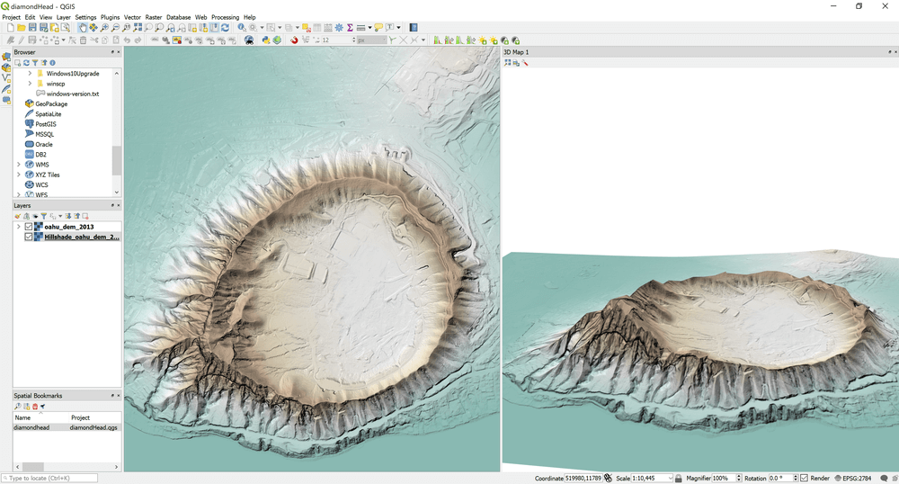
QGIS also allows users to edit vector data on desktop platforms. This allows you to establish defined boundaries and create realistic landscapes. This software stands out from the other free options because it simplifies the editing process. The editing tools are very intuitive and highly customizable. Some open-source tools can lack educational information for new users. This is not the case for this option. QGIS has strong tutorials and informative material, which you can explore here.
Unfortunately, many users reported experiencing software crashes. This is a common issue for open-source software, so be sure to frequently save changes to your map layout. The user interface for QGIS is a bit outdated but still easy to navigate. Older, more experienced users may find this familiar, while newer ones may feel it out of place. There is a learning curve for all of the extra feature sets offered by QGIS. As mentioned, there is fantastic educational material available for those with the time and knowledge to take advantage of it.
Bottom Line: QGIS is a smart choice for those who want to create interactive visualizations. The vector editing tools offer users a higher level of precision in their 3D maps. The plugins improve customization and expand software functionality. However, beginners may feel overwhelmed by the number of additional features.
“QGIS is a great alternative to expensive GIS software for non-profits and new users who are looking to enhance their data visualization and reports to stakeholders. Organizations who are afraid to make a jump and invest in comprehensive GIS software should feel safe and comfortable giving QGIS a try and introducing employees to GIS information software to help improve how they use and learn from data.”
Ember Urbach | Project Manager | Non-profit Quarterly, 10,001+ employees
I Need GIS Software with Enhanced CAD Tools and Mobile Apps
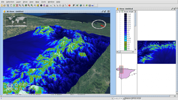
gvSIG: gvSIG is another free GIS software that excels in visualization capabilities. It offers 3D visualizations through a plugin that is based on the NASA WorldWind SDK. The 3D maps are just as detailed and realistic as those created in QSIG. However, gvSIG has a smaller community support network to guide beginners through using the visualization features.
gvSIG is well suited for users who want to create engaging geovisualizations. The basic mapping functions are extremely limited when it comes to symbology. Plugins are available to extend the gvSIG symbol library.
The main benefit of choosing gvSIG over other free GIS software is access to an extensive CAD toolbox. The CAD tools allow you to edit vector data and complete geoprocessing tasks. gvSIG offers the widest range of CAD tools to manage geospatial data. CAD tools are essential for converting your data into engaging visualizations.
gvSIG is the only free GIS software on this list that also functions on mobile apps. The gvSIG Mini Maps gives users access to a completely free set of maps from multiple sources. You can use MiniMaps to navigate with GPS and share your location. gvSIG Mobile is designed for field data collection and offers a more user-friendly interface. The downside of the mobile apps is that they are only available for Android devices.
Bottom Line: gvSIG is a fantastic option for GIS users who need strong CAD tools and visualization capabilities. If you are only interested in creating basic maps, then you should explore GIS software with fewer visualization features. The Android mobile apps are useful for field workers who need GPS navigation and data collection tools.
I Need Basic, User-Friendly GIS Software
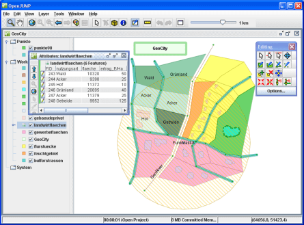
OpenJUMP: OpenJUMP is a great free option for beginners who want to keep their maps simple. Unlike QGIS and gvSIG, OpenJUMP does not offer advanced visualization features. It also does not have as many plugins to expand software functionality. This software releases updates less frequently than the previously mentioned open-source products.
OpenJUMP does connect to the World Map Service (WMS), which allows users to receive georeferenced images from a server. You can use the images to update your maps with more current geospatial data. OpenJUMP users can also share their completed maps with other people who have access to the WMS server.
The software allows you to upload GPS data from compatible devices. Users will need to add the GPS plugin and extension to create maps from that data. This feature enables users to easily access data from common GPS devices.
Bottom Line: OpenJump is great for people with limited experience, time, or who have less complex needs. You can receive georeferenced images from the WMS to keep your location data up-to-date. Also, the GPS plugin and extension are useful for uploading data straight from a GPS-enabled device. OpenJUMP has a dedicated user community and a Wiki page with instructions on using different features.
I Need Established GIS Software with Geoprocessing Tools
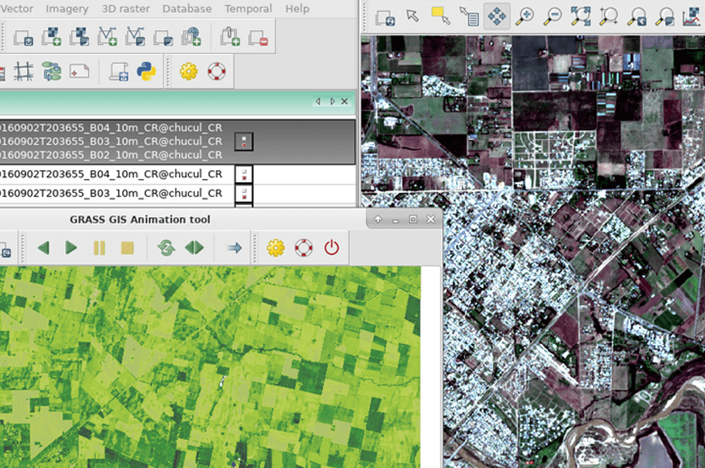
Geographic Resources Analysis Support System (GRASS) GIS: GRASS GIS has been around since 1982, making it one of the most well-known GIS software options. The U.S. Army Corp of Engineers originally used GRASS GIS for environmental research and land management. GRASS GIS is cross-platform and highly customizable software.
This software offers the most geoprocessing tools out of all the open-source GIS products. You can use these tools to manage and analyze geospatial data. There is an entire section of the GRASS GIS website dedicated to teaching beginners how to use these tools. The manuals and tutorials help users overcome the learning curve for GIS software.
GRASS GIS is not well suited for users who want to create basic maps. It has serious restrictions for storing map projections, which contain spatial data. GRASS GIS only allows users to store one map projection per folder location.
Bottom Line: GRASS GIS should be used for advanced geoprocessing instead of creating simple maps. Although the software has a steep learning curve, there are resources available on the GRASS website dedicated to educating beginners.
More GIS Software Options
If you are interested in learning more about commercial GIS software, check out our GIS category page. Commercial GIS software is designed for businesses that prioritize stability and customer support. ArcGIS is a popular desktop GIS software for mid-size and enterprise companies that handle large data sets. You can learn more about ArcGIS by visiting the ESRI website.
Was this helpful?